My Widget Experimet
This is the widget area for my history blog.
brittanynueslein.onmason.org by Brittany Nueslein is licensed under a Creative Commons Attribution 4.0 International License.
Apr
24
Online Security and Omeka
April 24, 2014 | Final Project, Theory and Practice | 6 Comments
Online Security
In terms of how safe I am online, I would love to assume that I am doing everything in my power to keep hackers out. Frankly, this is not the case. I do not use any anti viral software on my computer nor have I looked into purchasing any. Luckily, I have never encountered a problem to need viral software, but it would be safer if I invested. As far as my passwords go, I try to use as many as I can. By doing so, I often forget which password goes where so I end up sharing passwords with almost all of my accounts except my bank account. My bank account is a whole different story. I was affected by the Heartbleed bug and my bank account was then wiped by a third party, leaving me penniless. I never click on emails I don’t know where they’re coming from, but I have a gut feeling I made a credit card purchase at a store who’s software was affected by the Heartbleed. I am much more careful now online then I have ever been before. I have to admit, it does kind of scare me that anything I put on the internet, a “bad guy” has already seen. Kinda freaky, right?
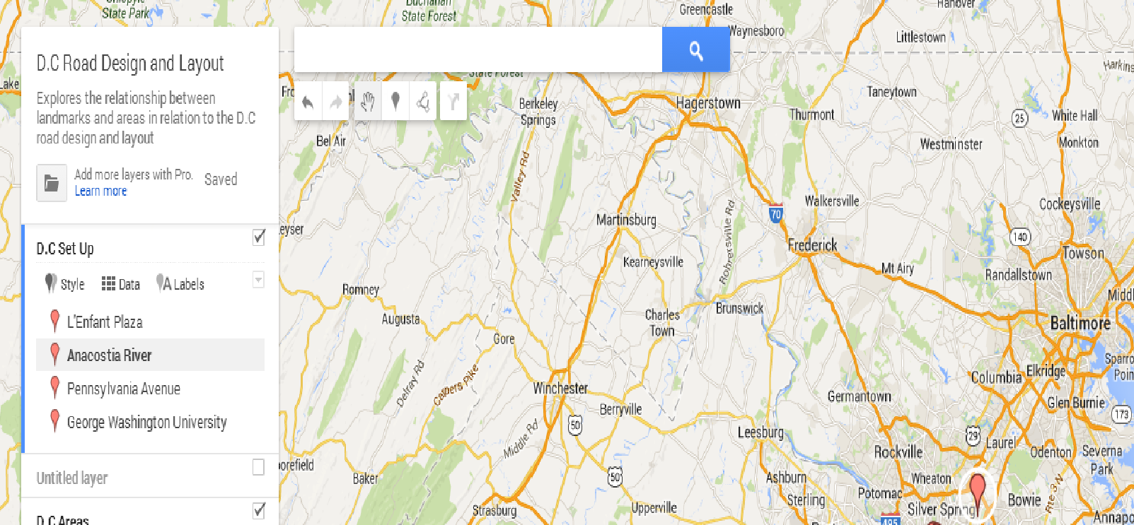
Omeka
This week, I have continued to collect items to add to my online exhibit. I made a trip to the library, but could not locate any of the materials you suggested I should check out. This was frustrating that they have every issue of Washington and History Monthly except for the exact issue I needed. To make up for the lost time in the library, I have located a few reputable online sources. Some of these sources are news articles, but one in particular talks of the design aesthetics of D.C which I thought was truly interesting. I found a comparison of two plans which will definitely be helpful.
It is really frustrating trying to find any primary sources in regard to road design. I have maybe two. I think it will be more worth my time to stop the hunt for these unknown primary sources and concentrate on the context and facts of my secondary sources.
Apr
22
ICharts
April 22, 2014 | Theory and Practice | Leave a Comment
ICharts: Neither a success or a failure.
So basically, since I am not dealing with figures for my research, a chart would be considered relatively useless. I have tried IChart numerous times and I still have to to figure out how it works. I can load the data but creating the actual chart is a whole different scenario. IChart seems to have hacked my Google account so I am now locked out of both making it somewhat impossible to even create this chart.
If I were to make a successful chart, I suppose I could investigate the relationship between other transportation modes. This still doesn’t seem too relevant to my project but if I have to have a chart I’ll make it work. Instead of a screenshot of my failed chart, I’ll include a shot of the data I was going to use for a practice chart.
Sample IChart: Relationship of Population to Area Settlement
Apr
14
Exhibit Plan
April 14, 2014 | Final Project | 2 Comments
Omeka
For my online Omeka exhibit, I intend to organize my items into an exhibit showing D.C roads in general terms. For this exhibit, I would like to include a variety of materials such as maps, and websites. Eventually I would like to add a few books into my exhibit, but have yet to go to the library to investigate which books would be the most helpful. So far my items include:
- 2 items on the grid system of roads in general
- 1 map of the original plan of D.C
- 2 items on the D.C road layout and design in specifics
- 1 item on the purpose of the design and traffic circles in specifics
My items are listed on my Omeka site which include the author of the source, the type of source, and title of each.
Apr
9
Project Progress
April 9, 2014 | Final Project | Leave a Comment
During this week, I have been able to add up to six items onto Omeka as well as organize them into two different categories. I plan to make a trip to Fenwick library later this week to investigate some books for the context of my project.
I have been very successful with Omeka, it has really gotten me organized and I know exactly which sources will give me the most information.
However, I have been having issues finding relevant primary sources for my project. Just about all of the primary sources I can use are maps and it is rather hard to use information only provided through maps. I think I need to start looking more into maybe the public’s response to the road system from when they were first built.
Apr
7
Text Mining: Is It Useful?
April 7, 2014 | Theory and Practice | Leave a Comment
Text Mining
Text mining is the delivering of high quality information through the use of data, in this particular case the data would be text. We explored how to use various text mining resources such as Wordle and Google Ngram. Although these show interesting relationships between text and word choice, for my particular project text mining would not be helpful.
I learned that in only certain cases text mining is useful. For instance, if I were doing a project based around a historical figure of D.C delivering a speech, text mining would be useful because I would be able to pinpoint exact words that were used repeatedly in order to create emphasis which would further show the subject and main points of the speech. Wordle would especially be useful for this because you would also be provided with a “text picture” that could be included in your project to create a visual appeal.
Since my project deals mostly with road design and the context behind that, text mining would be relatively useless. Most of my facts and data will be coming from maps and books, I don’t necessarily need to know what words come up the most in my article or book.
Apr
4
Data Map: D.C Roads and Design
April 4, 2014 | Final Project | 2 Comments
In the creation of my Google data map, I not only encountered problems, but came to the realization that perhaps a map would not be useful in conveying information for my project. My research has gone mainly into the layout and design of D.C, pertaining in specifics to the roads. Since roads cannot be considered a main point of interest, it was difficult to convey information just based on one road. Some roads, however, hold historic importance, as seen in the descriptions in my data map. This is only relevant for a few of the roads chosen. The second layer was the most difficult to create considering I chose waterways and important counties. Perhaps these were not the best choice in creating my map, but they seemed to be the most relevant information. Since waterways and counties are so large, it was difficult to pinpoint the exact coordinates to get an accurate map depiction. Creating the second layer was a lot of trial and error. However, the different color icons and different shapes helped to make the second layer stand out which made the map more clear and visually appealing.
Mar
17
Research Question
March 17, 2014 | Final Project | Leave a Comment
How did D.C become a non grid set up city and what is the intended purpose of such a set up?
Mar
3
Copyright?
March 3, 2014 | Theory and Practice | Leave a Comment
Is it infringement? In my opinion, no.
Located in the header of the pages of the syllabus, uncited Calvin and Hobbes cartoons are found in the syllabus. Although they are not cited, it can be fair to assume that they are being used to illustrate ideas of the syllabus and are not being claimed as original work by the instructor. If they were to be claimed as originals by the instructor or were to be told that they are stolen images, then a copyright infringement can be assumed. It was stated, however, that in the lecture, sometimes you can use particular images and text without the rights or permission of the original creator. By not citing the information, however, it holds the person who placed the information there accountable in case it is viewed as copyright infringement. All in all, though, it seems that the use of the comics is not malicious and does not claim false originality or information so therefore I do not view the placement of the comics as infringement of copyright regulations.
Feb
26
Roads and Structure
February 26, 2014 | Final Project | Leave a Comment
Final Project Proposal
For my final project I would like to explore the history behind the set up of D.C. The unique non grid like pattern of roads using the diagonals is interesting and I would like to learn more about the architects who drew up the design, the modifications, and execution of the idea. In order to start researching this topic, I would start with investigating the history behind the architects, and then further find information by exploring the traditional city structure and use comparison to prove my map points. Most of this research can be done online, however some library books can be used as sources for the more historical part of city architecture.
Feb
19
Possible Research Topics
February 19, 2014 | Final Project | Leave a Comment

For the final research project, I have found topics pertaining to Washington D.C that are interesting and will be informative to research.
First Topic: Architecture
Washington architecture not only is some of the most diverse architecture, but calls into play multiple heritages and cultures.The architecture of Washington DC is not uniform and shows great variations. This includes the use of the dome, the column, and other more Gothic elements. The styles reflected in these buildings are neoclassical, gothic, Georgian and modern. These architectural styles are also reflected in many other monuments in Washington. I could further investigate the placement of the monuments and why there are certain monuments featured by judging their impact on history. Currently, I am taking Art of the Islamic World, and often we talk about the areas of D.C that have elements of Islamic art. I have found this class very interesting and wish to explore more on the topic. In order to research the topic, I can use not only online sources, but I can go to the library and use their databases, use my Islamic art textbooks to provide background on various elements, and can certainly go into D.C to do some more investigating in the history behind the architecture.
Second Topic: Impact of Race
After further investigation, the “Forgotten Race war of 1919” really struck my interest. I would like to research not only why this may have happened, but I would like to also research the impact it has had on Washington D.C’s history as a whole. Washington, D.C.’s historic racial divide has come a long way in regards to the violence seen in 1919. During this race war, a black neighborhood was invaded by a small army of white navy men armed with weapons after learning a white woman was possibly assaulted by a black man. This aggressive act of violence sparked the black neighborhood to fight back in attempts to defend their neighborhood. . In terms of research for this topic, the online databases of the library can be used to locate book sources. For internet sources, I can use a Google search utilizing keywords to find the best and most credible material. My room mate is taking a history course this semester, and I’m sure I will be able to use her textbook to not only find more information on the riot, but more background to provide the history of the tension created through the racial divide.
Third Topic: Layout of D.C
The class in which we explored the layout of D.C in regards to the history of the roads and how they came to be struck my interest and could be informative to do more research pertaining to the history of the non grid pattern Washington D.C is so well known for. The layout of the city calls into play culture as Thomas Jefferson requested plans from cities such as Amsterdam and Paris as a model for the D.C layout. Although L’Enfant is credited with the overall design of the city, I feel that it is important to do some further research of Andrew Ellicot to understand his influence and what credit he deserves. Not only can I research the layout, but I can research the history behind the naming of streets and the placement of certain buildings. I would be able to find a lot of information pertaining to such because of the construction constantly occurring since the late 1700’s. For the research of this topic I can use the library and online sources.